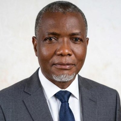
Dr. Mofolorunsho Samuel KOLAWOLE
Reader / Associate Professor
Faculty of Physical Science · Department of Geology
Specialization Igneous and Metamorphic petrology, Economic geology/Mineral exploration and applications of geochemistry and Remote sensing interpretation to solving geological and environmental problems
Office: Room 2, Ground floor, Faculty of Science building, Phase 2 Federal University Oye-Ekiti
Phone: 08138918675 and 08055943986
Email: mofolorunsho.kolawole@fuoye.edu.ng
Biography
Dr Mofolorunsho Samuel Kolawole is an Associate Professor in the Department of Geology, Federal University Oye-Ekiti, Ekiti State Nigerian. He is an Igneous and Metamorphic Petrologist whose works bridges Economic Geology, Mineral Exploration and the applications of geochemistry and Remote Sensing interpretations to the environmental studies.
Dr Kolawole has been teaching undergraduate and postgraduate geology courses for up to two decades. He has experiences in applying advanced geochemical analytical techniques such as Inductively Couped Plasma-Atomic Emission Spectrometry (ICP-AES), Inductively Coupled Plasma Mass Spectrometry (ICPMS), X-ray Diffraction (XRD), X-ray Fluorescence (XRF), Scanned Electron Microscopy with Energy Dispersive Spectroscopy (SEM-EDS), Electron Probe Microanalysis (EPMA) and Stable Isotope analysis to address geological problems. He is also very vast in interpretations of Remotely Sensed data like aerial photograph, LANDSAT MSS, LANDSAT TM, LANDSAT OLI, RADAR in a simplified and integrated GIS window to lithology, lineament and mineral resources mapping and solving other environmental problems.
Dr Kolawole has published widely in reputable peer review journals on the above-mentioned area of specialization. He maintained active scholarly profile on Google Scholar, ResearchGate, Scopus and ORCID for his research visibility, academic engagements and international collaboration.
Research Interests
Petrology (Igneous and metamorphic) geochemistry, Lithology, lineament and mineral resources mapping using Remotely Sensed data in solving geological other environmental challenges.
Qualifications
- PhD, Geology, University of Lagos, Nigeria (2018)
- M. Tech. Applied Geology (Mineral Exploration), Federal University of Technology, Minna, Niger State (2005)
- B. Tech. (Hons) Geology, Federal University of Technology, Minna, Niger State (1997)
- Interim Joint Matriculation Board (IJMB) A /Level, Kwara State Polytechnic, Ilorin, Kwara State (1988)
- West African School Certificate (WASC), Abdul Aziz Atta Memorial College, Okene, Kogi State (1986)
Professional Qualification
- Geoscientist - Council for Nigerian Mining Engineers and Geoscientists (COMEG), GEM 000856 (2008)
Membership of Professional Bodies
- Nigerian Mining and Geosciences Society (NMGS) C-07-3275 - Associate Member (2007)
- American Association of Petroleum Geologist (AAPG) 826442 - Associate Member (2003)
- Nigerian Society of Economic Geologists (NSEG) C-26-193. - Corporate Member (2026)
Paper Presentation - Local
- Lithogeochemistry of Granitic Rocks in the Kabba-Lokoja-Igarra Schist Belt, SW Nigeria - 51st Annual International Conference of Nigerian Mining and Geosciences Society, Lagos (2015)
- Geophysical Investigation of the Coal Prospect in Abocho area, Kogi State, Central Nigeria - 51st Annual International Conference of Nigerian Mining and Geosciences Society. Lagos (2015)
- Geology and Structural Characteristics of Basement Rock Exposures in the Kabba-Lokoja-Igarra Schist Belt, SW Nigeria - 51st Annual International Conference of Nigerian Mining and Geosciences Society, Lagos (2015)
- Mineralogy and Geochemistry of Pegmatite in Bunu Area SW, Nigeria. - 53rd Annual International Conference of Nigerian Mining and Geosciences Society, Abuja (2017)
- Geological Assessment of Basement Rocks Weathering Variability and Its Landscape Features in Zungeru Area, Northwestern Nigeria - 5th Annual International Science Conference of Faculty of Science, Federal University Oye-Ekiti, Ekiti State Nigeria. (2022)
- Geochemical Study of Precambrian Metavolcanic Rocks around Bunu Area, Part of Kabba-Lokoja-Igarra Schist Belt, SW Nigeria - 6th Annual International Science Conference of Faculty of Science, Federal University Oye-Ekiti, Ekiti State Nigeria (2023)
Postgraduate Ph.D Supervision
- Ogunleye Abinbolu Akindele - . Geology, Geochemistry and Industrial Potentials of the Ekirin-Adde Marble Deposit, (Ongoing)
- Aribigbola Akin Ebiyinka - Geology, Geochemistry and Industrial Potentials of the Ekirin-Adde Marble Deposit (Ongoing)
Postgraduate M.Sc Supervision
- Ogar, Obiom Enagu - The Geology, Geochemistry and Beneficiation Studies of Itakpe Iron-Ore Deposit (2026)
- Alli, Mustapha Abubarka - The Geology, Petrology and Geochemistry Ekirin-Adde Marble Deposit (Ongoing)
- Obafemi Joseph B. - The Geology, Petrology and Geochemistry Precambrian Basement Rocks around Oye-Ekiti Southwestern Nigeria (Ongoing)
Course Teaching
- GLY 207 - Introduction to Petrology (First Semester)
- GLY 305 - Igneous Petrology (First Semester)
- GLY 315 - Regional Geology of Africa (First Semester)
- GLY 317 - Crustal Evolution and Metallogeny (First Semester)
- GLY 325 - Metamorphic Petrology (First Semester)
- GLY 308 - Photogeology, Remote Sensing and GIS (Second Semester)
- GLY 312 - Exploration and Mining Geology (Second Semester)
- GLY 322 - Precambrian Geology and Geochronology (Second Semester)
- GLY 416 - Economic Geology (First Semester)
- GLY 422 - Geology of Nigeria (Second Semester)
- GLY 207 - Introduction to Petrology (First Semester)
- GLY 805 - Principle of Remote Sensing and Photogeology (First Semester)
- GLY 807 - Mineral Prospecting and Exploration (First Semester)
- GLY 809 - Geochemical Exploration I (First Semester)
- GLY 813 - Ore Deposits (First Semester)
- GLY 806 - Industrial Rocks and Minerals (Second Semester)
- GLY 816 - Ore Minerology (Second Semester)
- GLY 814 - Geochemical Exploration II (Second Semester)